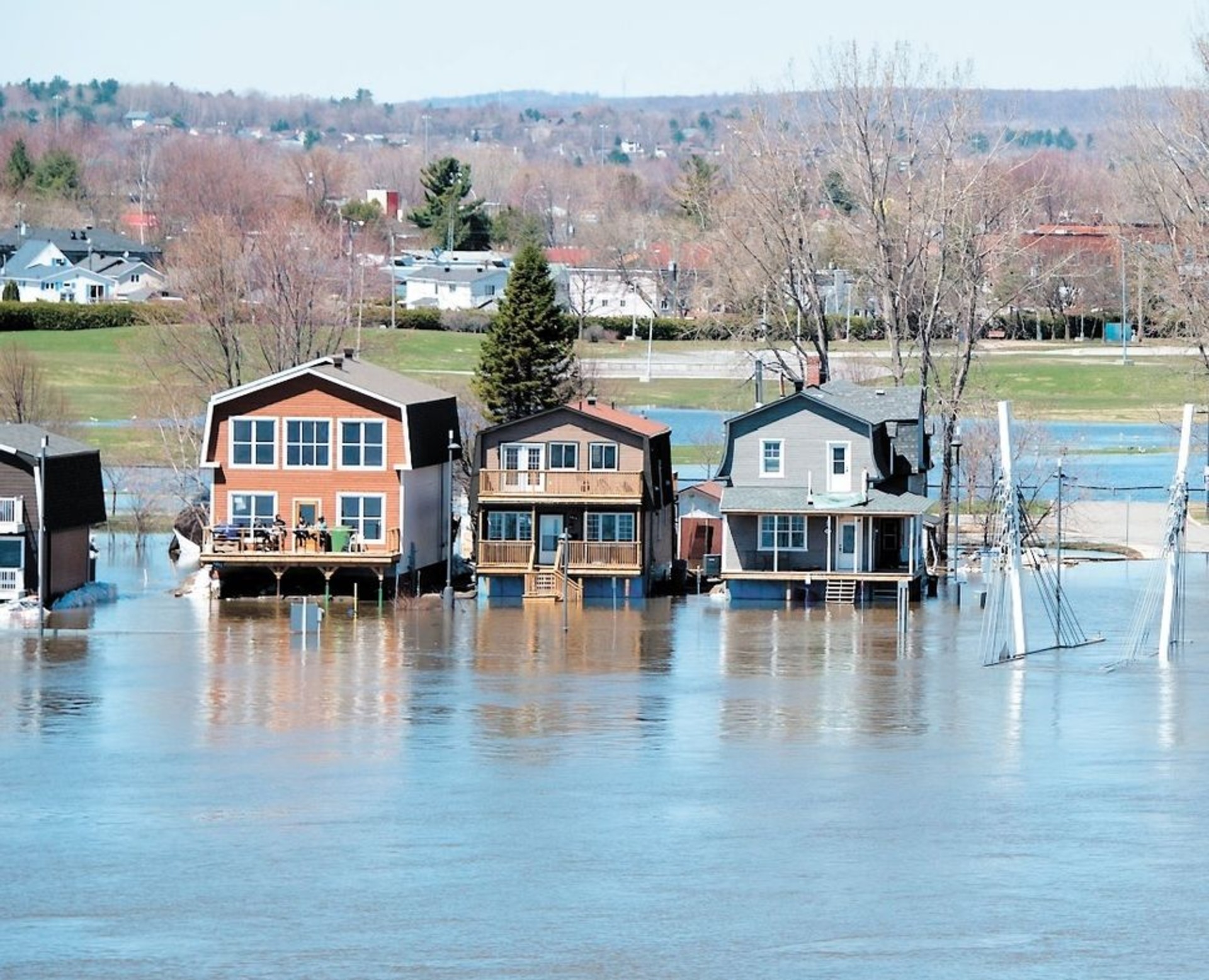
Take homes off provincial flood maps if they're not at risk, West Islanders beg!
30 Jan 2020
Pierrefonds-Roxboro mayor calls on Plante to act quickly, but city says lasting solutions take time to develop
Itsik Romano's home in Pierrefonds-Roxboro stayed bone-dry last spring, thanks to the borough's extensive underground infrastructure renovations and everything the city did to fend off the rising waters of the Rivière des Prairies.
But because his basement was flooded when sewers backed up three years ago, Romano's neighbourhood is included in the province's temporary flood maps.
Those flood maps were released about eight months ago, placing properties determined to fall in flood zones under an interim construction moratorium while Quebec creates a provincewide flood plan.
As long as they're in effect, Romano says, they are making it impossible for him to get full insurance coverage or a renovation permit, or to sell his home at a decent price.
He's among a group of West Island residents who want their properties taken off those maps since their homes were safe from flooding before 2017 and haven't flooded since.
The group is calling on the City of Montreal to move quickly to install permanent dikes along the river, rather than relying on hastily erected, temporary structures made of water-filled bladders and sandbags as they did last spring.
"We know that if they put those solutions on a permanent basis, we're not going to be flooded," said Romano.
Cities all over the world have been staving off floodwaters for generations by building dikes and using other time-tested techniques, he said, and now it's time for Montreal to do the same.
Borough mayor calls for solutions
Borough Mayor Jim Beis agrees, and he's urging Montreal Mayor Valérie Plante to act now rather than spend years talking about possible solutions.
"The meetings that we're having on a very rare basis, we're talking in general terms," said Beis. "The generalities have to stop."
He says it's Plante's responsibility to get the province and federal governments involved and to ensure that property owners whose homes are no longer at risk of flooding now that mitigation measures are in place don't suffer the consequences of having their properties included on flood maps.
Being a waterfront community, he said, it's inevitable that some homes will be on the flood map, but not "everything that's identified on that map has to be there."
Beis said the psychological stress on the community is enormous.
"I can't possibly tell people who have been living here for decades and generations that they have to pack up and leave because we have no idea on how to save their communities when we've done it temporarily," said Beis.
He hosted a news conference Wednesday with concerned residents at his side, insisting Plante get homes off the flood maps if they are proven to be safe from high waters. Beis also called for permanent flood-prevention infrastructure to be installed quickly.
Montreal is looking for solutions, Plante says
Speaking to reporters Wednesday, Plante acknowledged there is a disconnect between where the actual flood risks are and which sectors are on the maps. She said Montreal is in constant communication with the province on this issue.
A spokesperson for Quebec's minister of municipal affairs, Bénédicte Trottier Lavoie, said the government is planning to present a follow-up to the temporary flood maps, known as special intervention zones, in the coming weeks. That follow-up will include long-term mitigation measures for all of Quebec, she said.
"The goal is to rethink our territory and the way we manage it, particularly in light of climate change, so that it is sustainable and resilient," Trottier Lavoie said in an email.
Meanwhile, Plante said Montreal is "looking at all the possible solutions," including its investment in the Grand Parc de l'Ouest, or Great Western Park, which will help mitigate flooding in the sector.
Coun. Rosannie Filato said the $50 million in federal funding that the Project Montréal administration secured last summer to create that park will go, in part, toward preserving wetlands — a natural defence against flooding. Some of that money has also been invested in pumping stations and similar infrastructure, she said.
Filato, the city's executive committee member responsible for public security, said officials are working tirelessly to ensure the island-based city — not just Pierrefonds-Roxboro — is protected from the waters that surround it.
She said the city wants citizens to be safe and secure, but it does not want to make hasty decisions that might not be the right ones in the long run.
Several boroughs have requested permanent dikes, Filato said, but "we need to have a global approach because every dike that is placed in one sector can impact another sector."
Crucial infrastructure renovations and repairs over the last three years have proven effective, she said, as have the emergency response measures the city now has at the ready.
More than 1,000 buildings were flooded in 2017, she said, but only 110 got wet in 2019.
"But we really do have to start thinking on the long-term level," Filato said.
"We can't only have yearly procedures every time there are spring floods. We need to make sure we can have permanent structures and if we can't, we have to be transparent with citizens and find other solutions."
CBC's Journalistic Standards and Practices|About CBC News
RELATED STORIES
- Pierrefonds resident's return to his dank, wet home is bittersweet
- Flood map revision removes hundreds of West Island properties from high-risk zone
- Municipalities dealing with 'burden' of adjusting Quebec flood zone map before deadline
- With rain on the horizon, Quebecers told to brace for severe flooding
